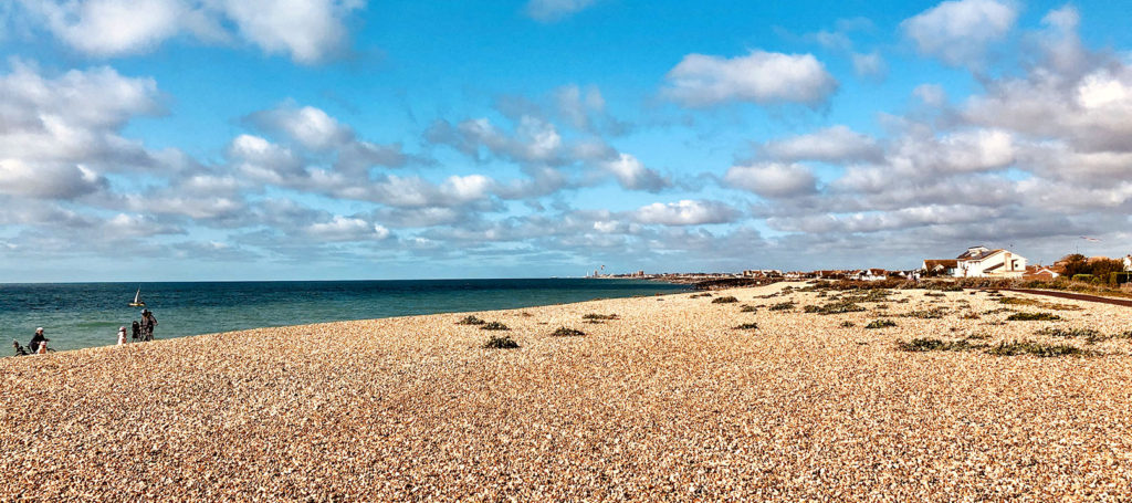
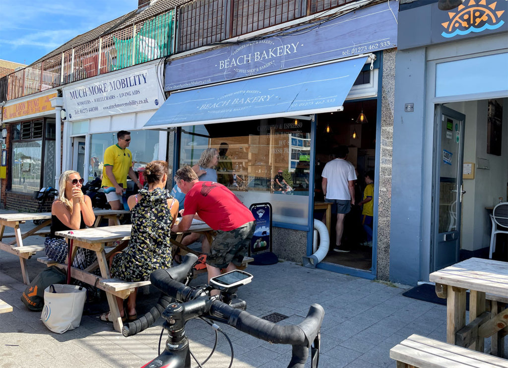
Situated a few miles to the west of Brighton is Shoreham. The Beach Bakery near the seafront has a good range of refreshments and is a regular stopping off point. Since the pandemic there is no longer indoor seating or toilets at this stop. However, public toilets are available close by and passed on all routes both on the way in and way out.
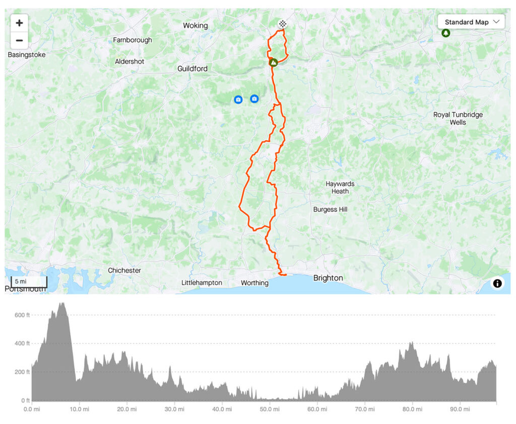
As with any long ride there are many ways to get there and back with loops ranging from 90 to 100 miles. Shoreham is sometimes preferred to Brighton as an early season long ride due to the ‘Shoreham Gap’, a break in the hills that means the coast can be reached without the significant climb of Ditching Beacon. However, most routes will still include climbing around 5000 ft / 1500 metres.
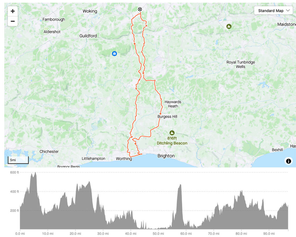
Routes
Route 1 – There and back
This is a 90 mile route with approximately 1400 metres / 4800 ft elevation
Get Strava route here
Get Garmin route here
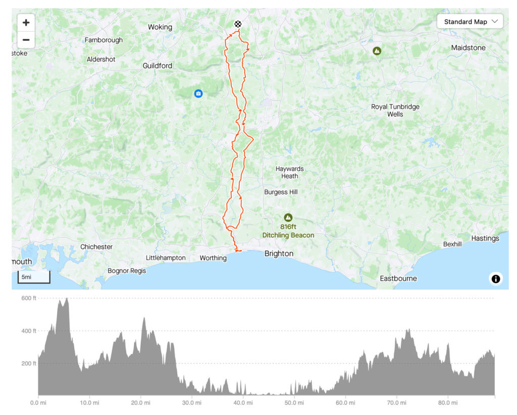
Route 2 – East Route
Hillier scenic route
This 97 mile route has 1700 metres / 5700 ft elevation. There is a long steady climb out of Shoreham with spectacular views across the countryside. The route also passes by Strawberry Fields, Rusper Village store and Tanhouse should further refreshment stop be required.
Get Strava route here
Get Garmin Route here
Route 3 – West loop
This route heads west first and passes the Cafe by The Lake at Barns Green after approximately 30 miles. If legs are weary this is can be an alternative destination. It’s quite rolling up until Barns Green but then the roads flatten out and the surfaces improve for the straight run down to the coast with only a few turns. The return is similar to Route 1, though the final few miles to Horsham head through Copsale and Sedgwick rather than Nuthurst and Monks Gate.
Get Strava Route here
Get Garmin Course here